
About
We aim to harness the big data and the AI revolution to develop innovative technological approaches to assess nature recovery in both fine detail and at large spatial scales.
We are in the midst of an exponential proliferation of data about our environment from sources as varied as a new generation of satellite sensors, social media posts and time-lapse cameras with image recognition. In concert with this data richness, there is immense potential to use AI/machine learning to fuse, interpret and correlate data to work at both fine spatial resolution and large spatial scale in the midst of significant complexity.
For the first time we have the potential to map and model ecological connectivity across whole countries, map different farming approaches or infrastructure in fine detail and track the connectivity of biodiversity associated with different farming landscapes. We will advance state-of-the-art AI approaches to combine different sources of data, including drones, satellite, survey data and social media, that are robust to a range of environmental scenarios, data noise and model reliability.
We will initially focus on three machine learning tasks to address the information requirements of our programmes:
- The exploitation of existing machine learning technology and subsequent identification and filling of methodological gaps
- Novel methods for data interpretation
- Requirements for hardware, imagery and human intervention for cost-efficient, scalable data analytics.
Projects
Ecoacoustics for assessing ecosystem health and function, from air to soil
Developing scaleable, transferable, and open approaches for ecoacoustics to assess nature recovery across global ecosystems

Ecoacoustic Data Analytics
Advancing AI methods to determine ecosystem composition from acoustic recordings, distinguishing species, geophonic & anthropogenic sounds in soundscapes as well as flagging unusual or unanticipated sounds.

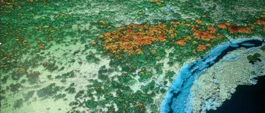
Understanding nature recovery paths and ecosystem functioning through forests health assessments
Quantifying the health of forests ecosystems by means of earth observation can aid in understanding nature recovery paths and ecosystem functioning

Robust ESG data for biodiversity
Financial institutions are increasingly aware of and interested in biodiversity- and nature- risks and opportunities, but such attempts have often been hindered by incomplete, incomparable and unreliable environment, social and governance (ESG) disclosure and scores.
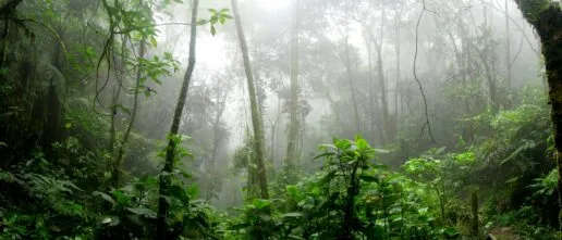
Mapping the resilience of tropical forests and savannas to global environmental change
Climate change effect on tropical forests

Mapping nature recovery at scale
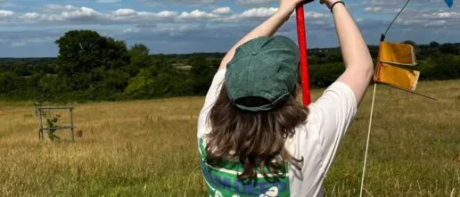
Our AI team is developing state-of-the-art AI approaches to combine different sources of data, including drones, satellite, survey data and social media, that are robust to a range of environmental scenarios, data noise and model reliability.

Mining the efficacy of Nature-based solutions
AI researchers are working closely with the Nature-based Solutions Initiative to mine the evidence base for the effectiveness of nature-based solutions to climate change mitigation and adaptation
Bridging Field Data and Vegetation Models: Forest Carbon Cycling Across Scales
Vegetation models have been used by many organisations (including the IPCC) to predict climate change on a global scale, but are these models getting the current ecosystem right?
Gold at the Margins: Analysing how fragmented governance and risk regimes shape ecological outcomes and exclusion in global mineral supply chains.
How formalisation policies, enforcement practices, and international due diligence regimes influence both ecological outcomes and local livelihoods.
Related Outputs
Tropical forests in the Americas are changing too slowly to track climate change
Species are expected to shift their ranges as the climate changes, but shifts may not occur fast enough, especially for immobile species such as plants. Two papers in this issue assess the degree to which plant species are tracking climate change in the American tropics, where data availability has constrained inference.
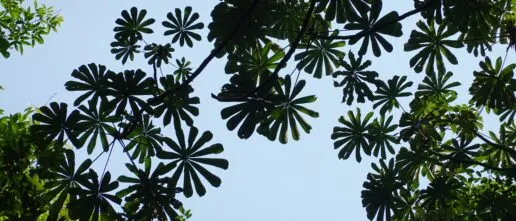
Canopy functional trait variation across Earth’s tropical forests
Tropical forest canopies are the biosphere’s most concentrated atmospheric interface for carbon, water and energy. However, in most Earth System Models, the diverse and heterogeneous tropical forest biome is represented as a largely uniform ecosystem with either a singular or a small number of fixed canopy ecophysiological properties. This situation arises, in part, from a […]
Assessing the Potential of AI for Spatially Sensitive Nature-Related Financial Risks
Evaluating and assessing nature-related risks for financial institutions is challenging due to the large volume of heterogeneous data available on nature and the complexity of investment value chains and the various components' relationship to nature.
The political ecology of cocoa agroforestry and implications for equitable land use in rural Ghana.
The relevance of cocoa agroforestry is widely discussed in debates on sustainability transition in cocoa, especially in the context of ending hunger and poverty among cocoa farmers. Whereas this has led to multiple cocoa agroforestry investments by NGOs, governments, and cocoa and chocolate companies in West and Central Africa, a notable gap exists in the […]
Contrasting carbon cycle along tropical forest aridity gradients in West Africa and Amazonia.
Tropical forests cover large areas of equatorial Africa and play a substantial role in the global carbon cycle. However, there has been a lack of biometric measurements to understand the forests’ gross and net primary productivity (GPP, NPP) and their allocation. Here we present a detailed field assessment of the carbon budget of multiple forest […]